
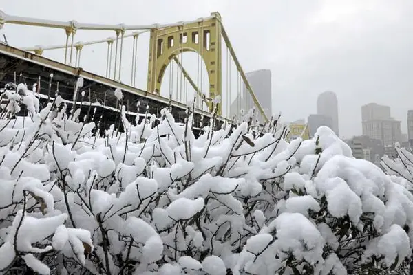
Forecasters say Western Pennsylvania could see the biggest snowfall in more than 15 years.
The National Weather Service has issued Winter Storm Warnings as meteorologists are predicting between 10 and 12 inches of snow will blanket the region this weekend.
The storm warnings, issued Friday morning, begin at 7 p.m. Saturday and last until noon Monday.
NWS meteorologist David Shallenberger said some flurries could come earlier in the day Saturday, but the bulk of the snow will start in the evening.
The highest intensity of snowfall is expected Saturday night through the day Sunday, Shallenberger explained, adding that precipitation will taper off by Monday morning.
In West Virginia, some of the snow could switch to freezing precipitation, which may slightly decrease snow accumulation totals there.
The confidence for a large impact winter storm has increased. Winter Storm Warnings have been issued across the entire area. Confidence is high for 6" plus totals across the entire area. To see the exact snowfall totals forecast go to our winter page here: https://t.co/cxojC578hxpic.twitter.com/CKh10H9fsN
— NWS Pittsburgh (@NWSPittsburgh) January 23, 2026
The upcoming snow is expected to rank among the highest accumulation totals the area has seen in recent years. NWS meteorologist Bill Modzelewski this week told TribLive the Pittsburgh area last saw 9 inches of snow in December 2020. The last snowstorm to hit 10 inches or more was recorded in February 2010.
Shallenberger urged people to stay off the roads if possible.
“That’s going to be quite a challenge for road crews to keep up on,” he said. “You’re going to be dealing with areas where people are getting stranded.”
Crews throughout the region are preparing for the snow, officials told TribLive.
Allegheny County officials said each of its 52 salt trucks has been inspected, equipped with plows and filled with salt and liquid calcium chloride.
But some towns reported running low on salt. Brackenridge officials, for example, said they got about half the salt supply they had ordered. In Plum, officials believe they’ll get through the weekend snow — but they may have to enter “conservation mode” after that.
Pittsburgh Regional Transit is warning riders that routes could be detoured as significant snowfall makes streets slick.
PRT in a social media post said the agency plans to deploy snowplows to clear busways and park and rides. The transit authority also will run additional rail cars to snow from accumulating on the tracks. Steel cutters place on rail cars will keep snow and ice off overhead power lines.
More on the coming storm
• Crews brace for snow, PennDOT sets priority routes for weekend storm
• Late salt deliveries could hamper storm response in some towns
Still, the authority warned several buses are likely to be rerouted if the area sees up to a foot of snow dumped on the roads. Officials said detours are especially likely in hilly areas.
“If buses are unable to get to hilly, snow covered, icy or otherwise impassable streets, they will stick to the main roads,” PRT wrote in a social media post. “A good rule of thumb is that if cars can’t drive on a street, buses can’t either.”
The Pennsylvania Department of Transportation encouraged people to “eliminate all unnecessary travel” during the storm. For those who are on the roads, PennDOT said people should carry a winter emergency travel kit, keep the gas tank at least half full, slow down, increase following distance, avoid sudden stops and starts, remove snow and ice from the vehicle and avoid using cruise control.
Anyone who gets stranded, PennDOT said, should remain in the vehicle until help arrives. Officials recommended running the engine every hour or so, making sure the tailpipe is clear and keeping a downwind window cracked open.
Shallenberger cautioned that people should stock up on food, prepare generators if they have them and ensure they have ways to stay warm, even if they lose power.
“This isn’t going to be a heavy, wet snow per se, but anytime you get snow and the winds we’re going to do deal with, you have the potential for power outages,” Shallenberger said.
Temperatures are expected to remain frigid this weekend and through next week, meaning mother nature won’t be of much help in melting the snow.
“We do not have a forecasted high temperature that gets above freezing until February,” Shallenberger said. “So whatever falls — sure, if you have those bright, sunny days, you’re going to get some sublimation — but with the amount of snow you’re going to get, it’s going to be with us for a while.”