
If you have a flat, elevated surface and a ruler, you can help the National Weather Service gather data and refine its forecasts this winter.
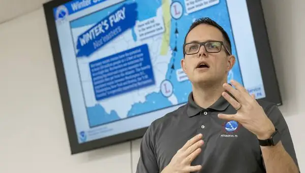
“When we get snowfall reports, it helps us understand what’s going on and better predict weather in the future,” said NWS meteorologist Jason Frazier. He was joined by about 25 people recently at the Slickville Volunteer Fire Department, where he discussed how the National Weather Service creates its forecasts and how regular citizens can assist.
“The more data we have, the better we can inform the public,” Frazier said.
One of the primary reasons the NWS seeks volunteers for its Skywarn program is a limitation of technology: the radar beams sent out from Moon Township cannot follow the curvature of the Earth.
“When we send the radar out, any precipitation it hits bounces back to us. But as it gets farther and farther out, it gets higher and higher from the Earth’s surface,” Frazier said. “So as it gets out to eastern Westmoreland or Somerset counties, sometimes the beam will go over top of where snow is actually falling.”
Having a network of volunteer weather spotters on the ground helps meteorologists like Frazier fill those gaps during critical decision-making moments.
Clippers, lows and nor’easters
Frazier also laid out the various winter weather patterns that move through Southwestern Pennsylvania, including “Alberta Clippers”— low-pressure systems that develop across Alberta, Canada, and typically dip southeast.
“Just recently we had some clippers that brought in quick hits of snow and cold air,” Frazier said. “But they aren’t our big-snow-accumulation-type patterns.”
The systems responsible for heavy accumulation are known as “Colorado Lows.” These develop along the Colorado front range and move east across the U.S.
“As it moves east, air around it is moving counterclockwise and at some point it’s tapping into moisture from the Gulf of Mexico,” he said. “As it reaches the Atlantic Coast, it can draw in moisture from the ocean.”
As Colorado Lows move north, they interact with polar air and transition into freezing rain and snow. These systems — combined with Southwestern Pennsylvania’s unique geography — are largely responsible for the “wintry mix” common in the region.
“Sometimes we’ll see a last-minute surge of warm air come up the Appalachian Mountains, and it changes the forecast from what we thought would be snow to sleet, freezing rain or just rain,” Frazier said.
The “true villain” of winter weather, however, is the nor’easter. These systems develop primarily along the Gulf or Atlantic coasts and can transform into massive low-pressure engines.
“With all that cold air, you can really get snow dumped on you,” Frazier said. “When we’ve gotten 10, 15, 20 inches of snow? It’s typically a nor’easter that causes it.”
Volunteers are critical
National Weather Service meteorologists run hundreds of weather models four times each day to form the most accurate forecast they can, along with sending up weather balloons to gather data on the various levels of warm and cold air in the atmosphere.
But real-time information from weather spotters on the ground — and there are between 350,000 and 400,000 Skywarn volunteers spread across the U.S. — is a crucial part of developing the most accurate forecast possible.
Andy Byrne of Export, who lived in Memphis for 15 years, was among those in attendance.
“It’s part of ‘Tornado Alley,’” Byrne said. “I attended about a half-dozen of these sessions down there over the years. I just really find weather fascinating.”
Kevin Heasley of Murrysville attended a Skywarn training session about a year ago.
“I learned a lot, and I’m just really passionate about weather,” he said.
Seven Barber of Pittsburgh agreed.
“I’ve done a little bit of storm chasing in the central U.S.,” Barber said. “But I’ve always loved meteorology and I studied it in college.”
If they chose to sign up for the Skywarn program, their instructions for winter are pretty simple: Submit a report to the National Weather Service with the time, date and location when there is snowfall over 1 inch, anytime freezing rain occurs, anytime there is significant flooding or when the wind is gusting at at least 50 mph.
In addition to working toward winter weather Skywarn certification, which can be done through the NWS website at Weather.gov/skywarn, Frazier also encouraged potential volunteers to sign up for the Community Collaborative Rain, Hail & Snow Network known by its acronym, CoCoRaHS.
“They’ll provide you with a rain gauge to use in a daily weather observation that you can report, and all that data comes to us,” he said. “When the news talks about who got what in terms of inches of snow, that’s all information coming from CoCoRaHS.”
A phone app called mPing also tags a user’s time and location, allows them to input various weather events, and submit data to the NWS.
Frazier emphasized that weather reporting volunteers don’t have to confine their reports to their hometown.
“Someone who’s reporting weather might be reporting it from where they live, but they can also report it from wherever they happen to be,” he said.
For more, see Weather.gov/skywarn.