
Emergency crews and weather experts are keeping an eye on ice jams on the Allegheny River in Emlenton, Venango County, to determine what might be heading toward Freeport, Harrison and points farther south over the next two days.
“There’s some ice jams happening upstream and impacting structures by the water there,” said Shannon Hefferan, meteorologist with the National Weather Service in Pittsburgh.
“We won’t be seeing anything downstream just yet until that breaks free.”
Ice jamming continues on the Allegheny River. Residents in nearby communities should monitor the situation closely. Here are some photos from the Emlenton, PA local fire department this morning. pic.twitter.com/CTIZuMtMgO
— NWS Pittsburgh (@NWSPittsburgh) February 20, 2026
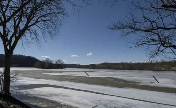
A frigid cold snap in January caused the river to freeze for the first time since 2018. Reports on the thickness of the ice vary from 3 to 6 inches.
Overnight heavy rain combined with milder temperatures this week to cause the ice chunks to start moving. Temperatures Friday climbed into the mid-60s.
A flash flood warning was issued until 7 p.m. Friday for parts of Armstrong and Butler counties, as well as Clarion and Venango.
A flood watch is in effect until 9 a.m. Saturday for municipalities closer to Pittsburgh, with rising water most likely to happen in Connoquenessing and Redbank creeks, as well as the Allegheny River.
Hefferan said areas near East Brady, Rimer and Templeton will be most impacted as water keeps making its way down from the ice jam before finally emptying into the Ohio River in Pittsburgh.
No warnings had been issued for Allegheny County as of Friday afternoon.
“People will start to see ice chunks streaming down but they should not impact structures,” she said.
“Hopefully the ice chunks can find a channel and the water can flow freely without causing any problems.”
Fire departments will be monitoring the riverbanks closely. Emlenton Fire Department issued a warning on Facebook that ice jams can cause water levels to rise quickly and cause flooding. Residents should be ready to leave at a moment’s notice, the post said.
A weekend forecast calls for 1 to 2 inches of snow Sunday, which should stall the ice chunks from moving. Temperatures are expected to drop into the 30s Sunday, Hefferan said. Lows Sunday night will be in the 20s.
“The colder temperatures would cause things to freeze up and not move. Everything might just sit where it is if they don’t flush out within the next 24 hours,” she said Friday afternoon.
The Army Corps of Engineers posted to Facebook, urging people to stay off the rivers.
“As temperatures climb, ice on the waters may still look solid but solid ice doesn’t mean safe ice,” the post said.
“Remember: thin ice is hard to spot and easy to break.”