
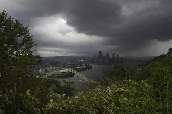
It’s time to break out the umbrellas and rain in Western Pennsylvania.
There’s a chance for showers and thunderstorms every day this week, according to Liana Lupo, meteorologist at the National Weather Service in Moon.
“It’s going to be more of a scattered coverage,” she said, which is similar to the last few days in the region. “Not everyone will be seeing the rain.”
Rain will most likely be seen in parts of Westmoreland Fayette, Greene and potentially Allegheny counties, according to Lupo. She called the rain “pop-up showers” due to their sporadic nature.
“It doesn’t mean it’s definite,” she said of the gloomy forecast. “That’s just the kind of pattern we’re in right now — nonstop chance for rain every day.”
Areas south of Pittsburgh will be hit the most, she said, especially in West Virginia.
Wednesday and Thursday have the most potential for severe weather, at about a 15-30% chance, Lupo said. Severe weather could include hail, wind or tornadoes.
“(It’s) a little far out to tell,” she said.
Meteorologist Jill Szwed at WTAE said there’s a chance for “at least an isolated shower” daily through Thursday:
- Monday’s activity will be primarily to the south and isolated in nature
- Tuesday will bring periods of rain for the entire region with an afternoon wave of rain and storms
- Wednesday looks to be a “typical” summer day with storms bubbling up during the heat of the day
- Thursday will see more scattered showers
“The recent rain has been incredibly location dependent,” she said. “Some spots are beyond soaked. Meanwhile down the road, rainfall has been manageable.”
For example, Szwed said the rainfall total at Pittsburgh International Airport since June 1 is about “normal,” but parts of the South Hills and eastern Allegheny County have picked up inches of rain at a time.
“Our pattern has been active and on the wet side in recent weeks,” she said.
Pittsburgh’s wettest months, on average, are still ahead of us this summer, Szwed said.
There’s a flood watch in effect until 10 p.m. Monday night, according to Lupo, because there’s not much flow of wind moving storms across the region. Instead, they stay relatively stationary and create concern for flooding.
Szwed said the flood watch is in effect for Allegheny, Washington, Westmoreland, Fayette and Greene counties.
“These areas have been impacted multiple times by flash flooding over recent days,” she said. “Plus, the ground is saturated all across Western PA.”
Flooding will depend on the rainfall, and heavy rain will be scattered across the region, according to Szwed.
“Downpours that develop will be capable of producing rainfall rates of one to two inches per hour,” she said. “It won’t take much more than that for flash flooding to begin.”
Lupo encouraged anyone who experiences or sees flooding to let the National Weather Service know.
“We want to hear it. Contrary to popular belief, we do not know everything that’s going on,” she said. “Don’t drive through it — (the) biggest thing is avoid flooded areas.”
The region won’t be dry again for certain until next Monday, according to Lupo. However, she said there’s a chance this coming weekend will be dry as well.
“That’s still far out, so things could change before that,” she said.